Release notes
Here you can find the release notes for Kanzi Maps.
0.5.5
Kanzi Maps now works with Kanzi 3.9.9.
In the TomTom backend, introduced support for the
road_lanesmap layer. This map layer contains features and geometry for rendering road lanes. See TomTom backend.Updated the Kanzi Maps application template, examples, and tutorials to use Python 3.
0.5.4
Kanzi Maps now works with Kanzi 3.9.8.
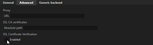
Introduced the SSL Certificate Verification (sslCertVerify) setting that lets you disable the SSL certificate verification.
0.5.3
Kanzi Maps now works with Kanzi 3.9.7.
Notable fixes
Fixed the issue that caused Kanzi Maps to terminate when you enable extrusion in the Route Renderer node. (444925)
Fixed the issue that caused Kanzi Maps to terminate when you set in a Renderer node the Cross-Fade Target property to < No Property >. (445268)
0.5.2
New features
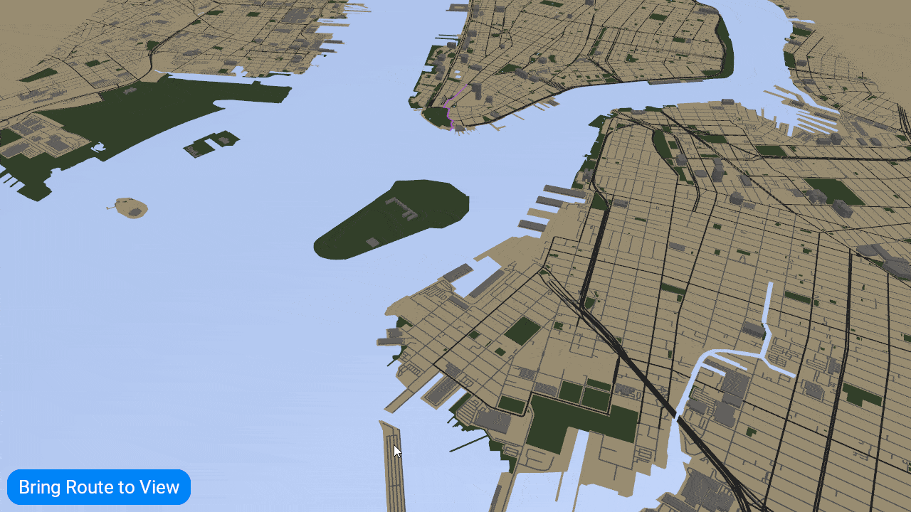
Bring to view
In a Map View node, you can set a view area and bring specific map content to that view area. See Bringing map content to a view area.
Changes
Kanzi Maps now works with Kanzi 3.9.6.
Notable fixes
Fixed the issue that prevented the Terrain 3D Level of Detail property from working. (436091)
Fixed the issue that caused the Zoom Level Editor to generate invalid bindings. (444280)
0.5.1
Changes
Kanzi Maps now works with Kanzi 3.9.5.
Notable fixes
Fixed the plugin name to be ‘maps’ in release packages.
The Kanzi Maps Palette works again.