Using the Geocoding Data Source
Use the Geocoding Data Source to get map features from geocoding results.
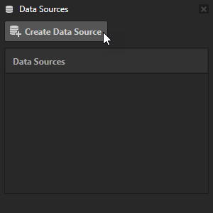
To create a Geocoding Data Source:
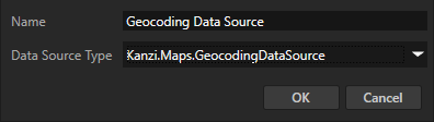
In the Data Sources window, click Create Data Source and set the Data Source Type to Kanzi.Maps.GeocodingDataSource.
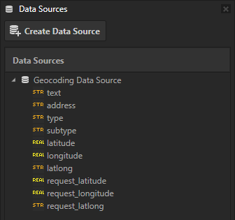
Next to the Geocoding Data Source that you created, click
 to create these data objects:
text contains a textual representation of the map feature.
address contains an optional street address of the map feature.
type contains the type of the map feature.
subtype contains the subtype of the map feature. The subtype depends on the map backend.
latitude contains the latitude coordinate of the center point of the map feature.
longitude contains the longitude coordinate of the center point of the map feature.
latlong contains the latitude-longitude coordinates of the center point of the map feature in string format.
request_latitude contains the latitude coordinate of the geocoding request.
request_longitude contains the longitude coordinate of the geocoding request.
request_latlong contains the latitude-longitude coordinates of the geocoding request in string format.
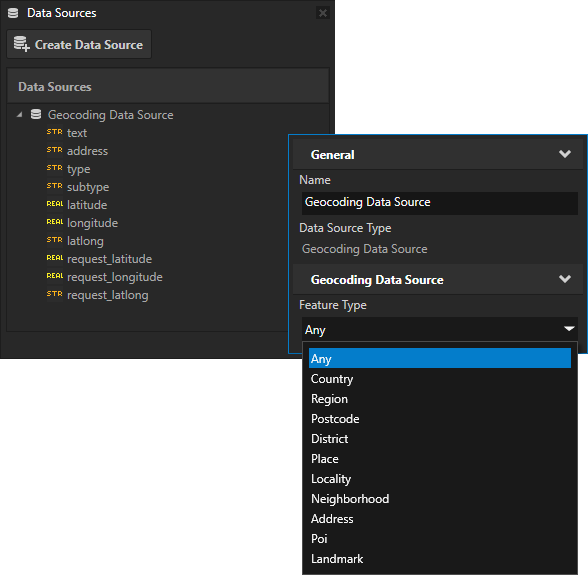
To restrict the geocoding result to a specific type of map feature, next to the Geocoding Data Source that you created, click
 and set the Feature Type property to one of the available values:
Country
Region
Postcode
District
Place
Locality
Neighborhood
Address
Poi
Landmark
To populate the Geocoding Data Source with a map feature, use the Set Reverse Geocoding Location action where you set the WGS84 latitude-longitude coordinate of the location for which you want to get map features.