Using the Tile Data Source
Use the Tile Data Source to create a list of features from the currently alive map tiles.
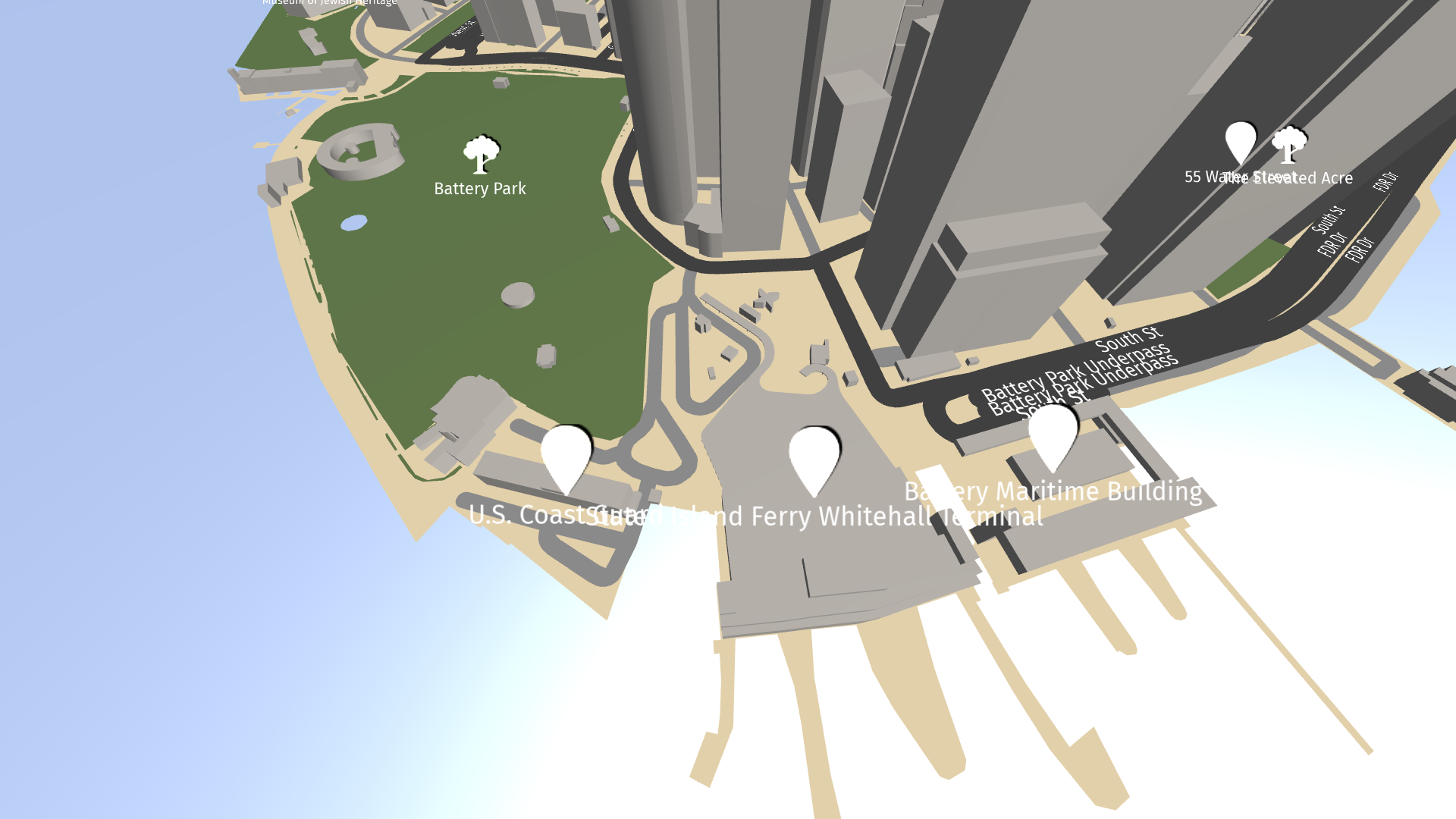
Learn how to use the Tile Data Source by completing a tutorial. See Tutorial: Points of interest and labels.
Tip
The Kanzi Maps assets include these Tile Data Sources that you can use with the Mapbox backend:
KanziMaps_MajorRoadLabelSource (Mapbox) provides data about major roads.
KanziMaps_POISource (Mapbox) provides data about points of interest.
KanziMaps_CityLabelSource (Mapbox) provides data that you can use to label cities.
KanziMaps_CountryLabelSource (Mapbox) provides data that you can use to label countries.
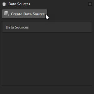
To create a Tile Data Source:
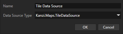
In the Data Sources window, click Create Data Source and set the Data Source Type to Kanzi.Maps.TileDataSource.
In the Data Sources window next to the Tile Data Source that you created, click
 and set these properties to configure the data source:
Layer Filter sets the name of the layer from which the Tile Data Source gets map features. See Supported backends.
Metadata Filter sets the boolean expression that determines which map features the Tile Data Source gets. See Metadata filters.
Minimum Zoom Level sets the minimum zoom level of the Map View node at which the Tile Data Source is active.
Maximum Zoom Level sets the maximum zoom level of the Map View node at which the Tile Data Source is active.
Maximum Feature Count sets the maximum number of features that can be active at the same time.
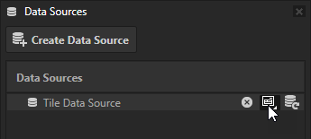
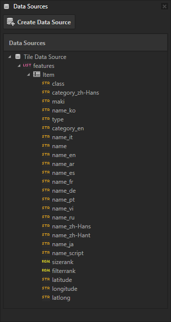
Next to the Tile Data Source that you created, click
 to populate the features list data object that contains all the alive map features in no particular order. Each map feature contains the metadata of that feature as data objects, as well as:
latitude: WGS84 latitude in degrees
longitude: WGS84 longitude in degrees
Internally the features also contain:
geometry: DataObjectMapGeometry instance, only usable within the context of the Kanzi Maps plugin.__id: DataObjectString that contains a 64-bit identifier as binary data. You can use this to de-duplicate features at tile boundaries.
The list of data objects depends on the metadata available for the selected map features. See the documentation of your map backend.
See also
Tutorial: Points of interest and labels
Using the Prefab Feature Renderer node
Using the Geocoding Data Source