Using the Route Data Source
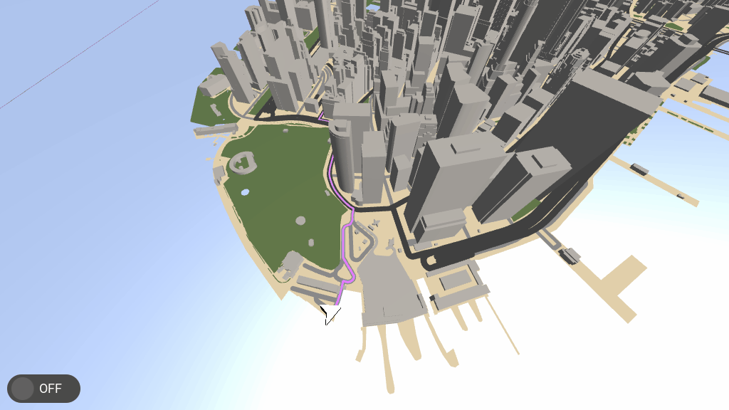
The Route Data Source provides data about routes.
Learn how to use the Route Data Source by completing a tutorial. See Tutorial: Navigation.
Tip
The Kanzi Maps assets include the KanziMaps_Route Route Data Source. See Using the Kanzi Maps assets.
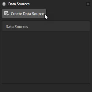
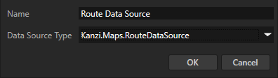
To create a Route Data Source:
In the Data Sources window, click Create Data Source and set the Data Source Type to Kanzi.Maps.RouteDataSource.
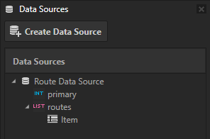
Next to the Route Data Source that you created, click
 to create these data objects:
primary contains the index of the primary route.
Use this to separate the primary route from alternative routes.
routes contains a list of routes where each route contains:
geometry
duration (seconds)
length (meters)
leg (for each leg of the route)
geometry
duration (seconds)
length (meters)
step (for each step of the leg)
duration
length (meters)
name (road or path name)
geometry
maneuver
instruction
modifier
type
See also
Using the Geocoding Data Source